First light for the Italian IRIDE programme
01 April 2025
Solenix is involved in multiple aspects of the IRIDE programme, contributing to downstream development activities—including the ground segment, services marketplace, and instrument expertise.
On this occasion, we also had the opportunity to support the programme’s communication and outreach, thanks to the trust placed in our team by ESA.
A few weeks ago, our team was asked to assist with post-processing and refining the first image from the IRIDE programme. The challenge was anything but trivial—after all, there’s never a second chance to make a first impression.
The high-resolution image we received was captured by the multispectral optical instrument aboard the 60 kg HEO Pathfinder microsatellite. Pathfinder is part of the HEO constellation, developed by a consortium led by Argotec, and was launched on 14 January 2025.
This instrument offers a maximum spatial resolution of 2.66 meters from an orbital altitude of 560 km and can capture imagery in panchromatic mode as well as seven spectral bands, ranging from RGB to near-infrared and red edge.
IRIDE is an ambitious Italian space programme initiated by the Italian goverment and developed with funding from Italy's National Recovery and Resilience Plan (PNRR). Coordinated by ESA with support from the Italian Space Agency (ASI), the IRIDE programme involves the deployment of six satellite constellations which together can potentially include more than 60 satellites.

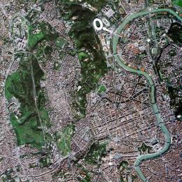
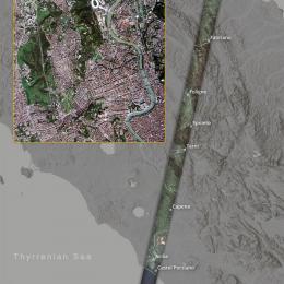
The post-processing steps included color balancing and georeferencing both the high-resolution image and the reduced-resolution strip. The image was also checked for band alignment and striping. Here below the final version.


Acquired on 5 March 2025, the image is part of a longer strip covering central Italy, extending from the town of Fano on the Adriatic coast, across the central Apennines, down to Rome, and about 20 km further south to Ostia on the Lazio coast. The visualized strip spans approximately 285 km in length and 11 km in width.
As a precursor mission, the Pathfinder aims at preparing the ground for upcoming missions that can match or even surpass the capabilities of well-established missions like Sentinel-2, which offers a 5-day revisit time, global coverage, a 290 km swath width, and advanced radiometric capabilities.
A wide range of applications and services will benefit from the data provided by the IRIDE constellation. Many of these services will be accessible to local and regional public authorities in Italy, highlighting the growing role of satellite technology in the routine management of urban and rural environments.
With text from the IRIDE programme interactive presentation and ESA's publication on the subject.